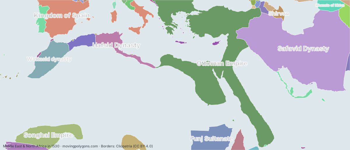
Middle East & North Africa in 1530
This map shows the 36 states and peoples the data has for Middle East & North Africa in that year.
Watch these borders move
Play the changes on an animated map, in your browser. Free, no account needed.
States and peoples in Middle East & North Africa in 1530
Largest first, by area on this map.
- Safavid Dynasty
- Ottoman Empire
- Kingdom of Spain
- Songhai Empire
- Funj Sultanate
- Wattasid dynasty
- Hafsid Dynasty
- Bornu Empire
- Kingdom of Portugal
- Mali Empire
- Zayyanid dynasty
- Khanate of Khiva
- Ethiopian Empire
- Khanate of Bukhara
- Shirvan
- Kingdom of Georgia
- Kingdom of Kakheti
- Kazakh Khanate
- Mughal Empire
- Papal States
- Republic of Venice
- Adal Sultanate
- Kingdom of Imereti
- Principality of Mingrelia
- Portuguese Africa
- Republic of Genoa
- Spanish Empire
- Holy Roman Empire Minor States
- Principality of Guria
- Kingdom of France
- County of Foix
- Republic of Ragusa
- Portuguese Empire
- Principality of Abkhazia
- County of Urgell
- Republic of Florence
New on the map since 1505
Kingdom of Spain · Funj Sultanate · Khanate of Khiva · Khanate of Bukhara · Kazakh Khanate · Mughal Empire · Portuguese Africa · Spanish Empire
Gone from the map by 1555
Shirvan · Adal Sultanate
Animated maps of this time
Middle East & North Africa in other years
Other regions in 1530
The outlines are coarse and follow the Cliopatria dataset: borders before modern surveys are estimates, and a blank area means the data has no state on record there, not that nobody lived there. A state that changed hands during the year can appear together with its successor.