Animated maps of the Netherlands
Two of these maps are about water. One follows the Dutch coast for 2,500 years, from sinking peat bogs and storm floods to dikes, polders and the Delta Works. The other shows six centuries of polder windmills, pumping stations and floods. The history maps cover the Burgundian state and the Dutch Revolt up to the Peace of Münster in 1648, the Disaster Year of 1672, the Dutch colonial world since 1588, and three regions over some two thousand years each: Friesland, Gelderland and Brabant.
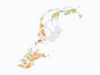
The other maps show the country itself changing: how Dutch towns and cities grew between 1300 and 2025, which party came first in each gemeente at every Tweede Kamer election from 1937 to 2025, and where 29 protected animal species lived between 1880 and 2026 (that map is in Dutch). On the coast map and the city map a colour is a period: land takes the colour of the time in which it was won from the water or built on.
12 maps
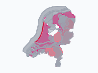
How the Netherlands Rose from the Sea, 500 BC–2026
2,500 years of the Dutch coast: how the peat bogs behind the dunes sank and drowned, how storm floods cut out the Zuiderzee, the Dollard, the Biesbosch and the drowned lands of Zeeland, and how the land was won back…
Eighty Years' War in the Low Countries, 1568–1648
The Dutch Revolt against Spanish Habsburg rule, from Louis of Nassau's invasion and the battle of Heiligerlee (May 1568) to the Peace of Münster (1648), shown only for the Low Countries and their immediate borderlands…
1363–1648
Burgundian State, Revolt & Republic
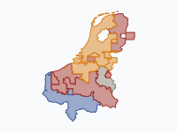
The Low Countries from Philip the Bold's Duchy of Burgundy (1363) to the Peace of Münster (1648). Four Valois dukes assemble the Low Countries by marriage, purchase and war; when Charles the Bold dies at Nancy in 1477…
1650–1715
Orange versus the Sun King · The 1672 Disaster Year and the duel of William III & Louis XIV
The Disaster Year (Rampjaar) of 1672 and the forty-year struggle it started between William III of Orange and Louis XIV, from William's birth in 1650 to Louis's death in 1715.
The Dutch Colonial World, 1588–today
The Dutch overseas world from the Republic of the Seven United Netherlands (1588) to the Kingdom of the Netherlands today: the trading posts and conquests of the VOC and WIC in Asia, Africa and the Americas, the…
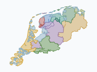
Friesland Through the Ages (12 BC – 2019)
Two thousand years of Friesland and the Frisian coast: the Roman-era Frisii, the Frisian kingdom of Radbod and its defeat by the Franks, Viking rule, the 'Frisian Freedom' without a lord, the Saxon takeover of 1498…
Read the article: The History of Friesland on a Map: Two Thousand Years of Rulers and Sea
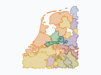
Gelre and Gelderland, AD 100–2026
How Gelderland took shape. The story starts on the Roman Rhine frontier, with the Franks, Frisians and Saxons and the Frankish gouwen.
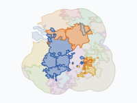
Brabant Through Time: Tribes, Duchy and Provinces (57 BC – 2026)
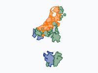
Brabant has been three different things under one name: a Frankish pagus between the Scheldt and the Dijle, a duchy (1183–1795) that reached from Nivelles to 's-Hertogenbosch, and since 1815 a set of provinces in two…
Read the article: Brabant Through Time: From Caesar's Belgae to Two Countries (57 BC – 2026)
Dutch cities grow, 1300–2025
How the towns and cities of the Netherlands spread across the land, from the walled towns of 1300 to the sprawling urban regions of today.
Read the article: How Dutch Cities Grew, 1300–2025: Seven Centuries on One Map
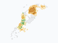
Mills Against the Water: Windmills, Pumping Stations and Floods in the Netherlands, 1400–2026
Six centuries of pumping the Netherlands dry, and of the floods that came anyway. Orange patches are fields of polder windmills: the darker, the more mills per 100 km².
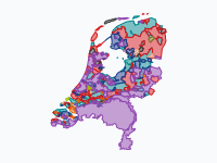
Who came first where: Tweede Kamer elections by gemeente, 1937–2025
Which party got the most votes in each gemeente, at every Tweede Kamer election from 1937 to 2025. Each colour is a party; a patch is every gemeente where that party came first, drawn on the gemeente borders of that…
Read the article: Who Came First Where: Dutch Elections by Municipality, 1937–2025
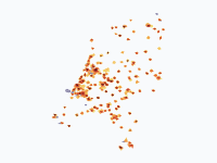
Beschermde diersoorten in Nederland, 1880–2026
Waar leefden 29 wettelijk beschermde (en deels uitgestorven) diersoorten in Nederland, van de eerste beschermingswet in 1880 tot nu? LEESWIJZER • Grijs = de soort komt er voor, maar is op dat moment niet wettelijk…
Read the article: Protected Animals in the Netherlands, 1880–2026: An Animated Map

Make your own animated map
Pick a region and two years, and watch the borders of that time move. You need no account to try it.
Create a map