Animated maps of ancient and medieval history
These maps begin in antiquity or the Middle Ages, and some run on long after. Rome is followed from the Republic of 509 BC to the fall of Constantinople, and its three wars against Carthage have a map of their own. The medieval maps cover the Anglo-Saxon kingdoms and the Norman Conquest, the lands of the kings of England in France from 1066 to 1558, the Holy Roman Empire, the Hanseatic League, the Italian maritime republics, the Mongol conquests and the first wave of the Black Death.
How to read them differs from map to map. On the Rome map each Roman state has its own colour and only directly ruled land is shaded. The Black Death map has no borders: land takes the colour of the half-year in which the plague reached it. On the Wars of the Roses map each army is a token that slides along its route. The Hanseatic League ruled no territory, so its map shows towns, not areas.
13 maps
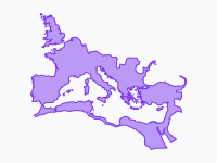
Rome — From Republic to Fall of Constantinople (509 BC – 1453 AD)
Two thousand years of Rome on one map: the Republic growing from a single city in Latium to master of the Mediterranean, the Empire at its height under Trajan, the breakaway Gallic and Palmyrene empires of the…
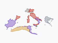
The Punic Wars: Rome against Carthage, 264–146 BC
Three wars between Rome and Carthage turned the western Mediterranean into a Roman sea. The First Punic War (264–241 BC) was fought for Sicily, mostly at sea.
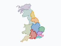
The Making of England (600–1071)
How a patchwork of Anglo-Saxon kingdoms became one England, from the Heptarchy and the Viking invasions to Alfred the Great and 1066: the rival powers of Northumbria, Mercia and Wessex, the Great Heathen Army and the…
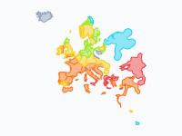
The Black Death (1346–1353)
The first wave of the Black Death, from the Golden Horde in 1346 to Moscow in 1353, modelled from more than 680 dated places. The map is an arrival-time surface: settled land takes the colour of the half-year in which…
Read the article: The Black Death: Mapping the Deadliest Pandemic in History
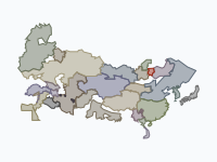
The Mongol Empire, 1206–1368
From one steppe clan on the Onon to the largest contiguous land empire in history, and its break-up into four khanates: 58 keyframes from about 1200 to 1370.
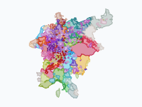
The Holy Roman Empire and Its Lands, 962–1990
Every duchy, county, march, prince-bishopric and free city of the Holy Roman Empire, and every land that ever formally belonged to it, from the coronation of Otto I in 962 to German reunification in 1990: the stem…
Read the article: The Holy Roman Empire and Its Lands: A Thousand Years of German Borders (962–1990)
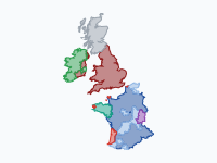
England on the Continent, 1066–1558
From Hastings to the fall of Calais: how the kings of England, from the Normans and Plantagenets to the Tudors, won and lost half of France.
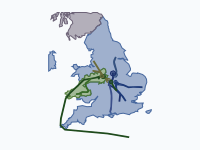
The Wars of the Roses, 1455–1487
Thirty years of civil war between the houses of Lancaster and York, told through the moving armies. Every march, landing, flight and battle from the First Battle of St Albans (1455) to Stoke Field (1487) is followed…
Read the article: Tapestry: History Maps Embroidered on Linen, After House of the Dragon
The Hanseatic League (1159–1669)
The rise and fall of the Hanseatic League, the confederation of merchant towns that dominated northern European trade, from Henry the Lion's refounding of Lübeck (1159) to the last Hanseatic Diet (1669).
Read the article: The Hanseatic League, 1159–1669: An Animated Map of Its Rise and Fall
Italian Maritime Republics & Their Overseas Empires, 1000–1797
How Venice, Genoa, Pisa and Amalfi built and lost their overseas empires, from Doge Pietro II Orseolo's Dalmatian expedition in 1000 to Napoleon's end of Venice and Genoa in 1797.
Read the article: Four Port Towns and Their Sea Empires: Venice, Genoa, Pisa and Amalfi, 1000–1797
Rise and Fall of the Mongols, 1162–1783
How a fatherless boy from the Onon River built the largest contiguous land empire in history, and how his descendants' realms fell apart over the next five centuries.
Spread of Christianity, 30–2025
How Christianity spread from a small Jewish movement in Jerusalem across the world, and which branch prevailed where. From c. AD 30 to 2025.
The Ottoman Empire (1299–1923)
The Ottoman Empire from Osman's beylik around Söğüt (1299) through its greatest extent on the eve of the siege of Vienna (1683) to the Republic of Turkey (1923); the last frame adds Hatay in 1939.

Make your own animated map
Pick a region and two years, and watch the borders of that time move. You need no account to try it.
Create a map