Africa in 2020
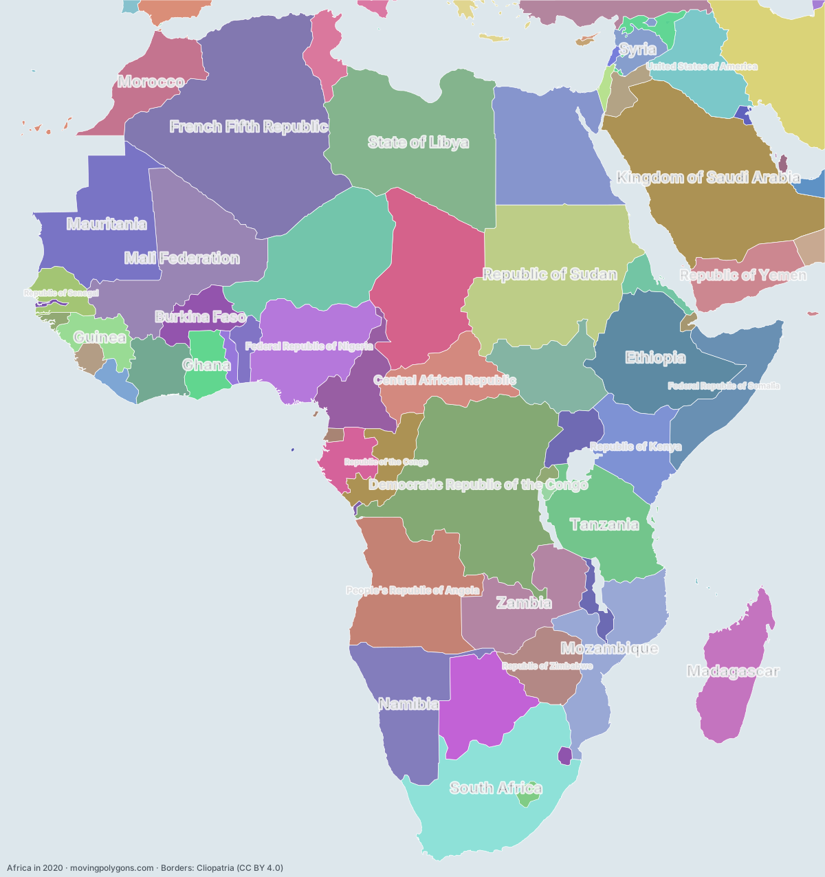
This map shows the 80 states and peoples the data has for Africa in that year.
Watch these borders move
Play the changes on an animated map, in your browser. Free, no account needed.
States and peoples in Africa in 2020
Largest first, by area on this map.
- French Fifth Republic
- People's Democratic Republic of Algeria
- Democratic Republic of the Congo
- Kingdom of Saudi Arabia
- Republic of Sudan
- State of Libya
- South Africa
- Republic of Chad
- Mali Federation
- People's Republic of Angola
- Republic of the Niger
- Ethiopia
- Mauritania
- Arab Republic of Egypt
- Islamic Republic of Iran
- Federal Republic of Nigeria
- Tanzania
- Namibia
- Mozambique
- Zambia
- Federal Republic of Somalia
- Madagascar
- Central African Republic
- Republic of Botswana
- South Sudan
- Republic of Kenya
- United States of America
- Republic of Iraq
- Morocco
- Republic of Yemen
- Republic of Cameroon
- Republic of Zimbabwe
- Republic of the Congo
- Republic of Côte d'Ivoire
- Burkina Faso
- Republic of Turkey
- Gabon
- Guinea
- Ghana
- Republic of Uganda
- Republic of Senegal
- Republic of Tunisia
- Kingdom of Great Britain
- Syria
- State of Eritrea
- Republic of Benin
- Kingdom of Spain
- Kingdom of Jordan
- Republic of Liberia
- Malawi
- Mujahideen
- Sultanate of Oman
- Sierra Leone
- Togo
- United Arab Emirates
- Third Hellenic Republic
- Lesotho
- State of Israel
- Republic of Guinea-Bissau
- Republic of Italy
- Republic of Rwanda
- Equatorial Guinea
- Republic of Burundi
- Republic of Djibouti
- Eswatini
- Kuwait
- Portugal
- Lebanon
- State of Qatar
- Republic of The Gambia
- Republic of Cyprus
- Turkmenistan
- Estado Novo
- Turkish Republic of Northern Cyprus
- Republic of Cabo Verde
- São Tomé and Príncipe
- Kingdom of Bahrain
- British Overseas Territories
- Gaza/Hamas
- Malta
New on the map since 1995
Democratic Republic of the Congo · State of Libya · South Sudan · United States of America · Republic of Iraq · Mujahideen · British Overseas Territories · Gaza/Hamas
Animated maps of this time
Africa in other years
Other regions in 2020
The outlines are coarse and follow the Cliopatria dataset: borders before modern surveys are estimates, and a blank area means the data has no state on record there, not that nobody lived there. A state that changed hands during the year can appear together with its successor.