Africa in 1942
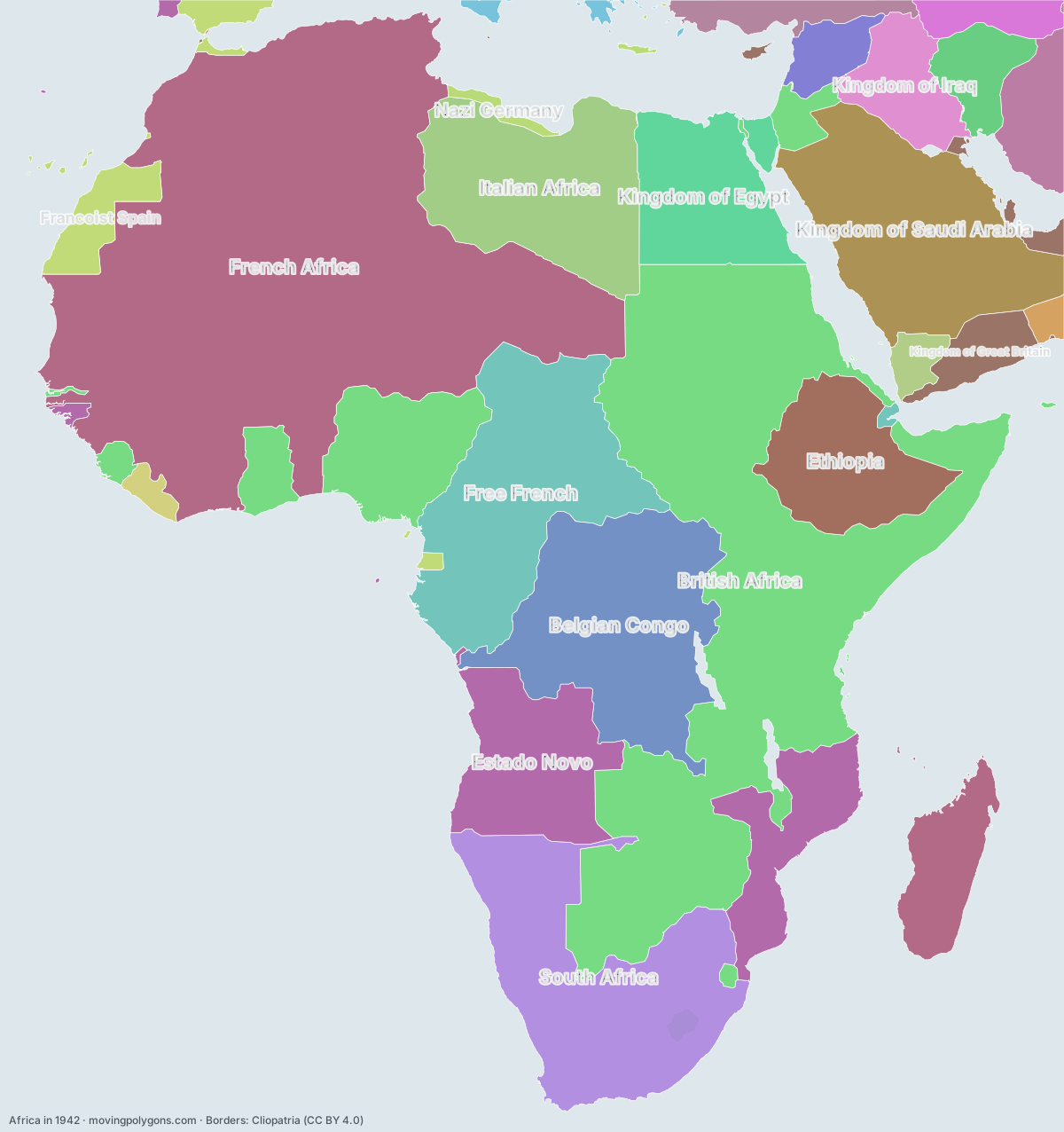
1942 is the Axis at its greatest extent. This map shows the 24 states and peoples the data has for Africa in that year.
Watch these borders move
Play the changes on an animated map, in your browser. Free, no account needed.
States and peoples in Africa in 1942
Largest first, by area on this map.
- French Africa
- British Africa
- Free French
- Belgian Congo
- South Africa
- Estado Novo
- Kingdom of Saudi Arabia
- Italian Africa
- Ethiopia
- Kingdom of Egypt
- Kingdom of Iraq
- Francoist Spain
- Pahlavi Dynasty
- Kingdom of Great Britain
- British Colonial Empire
- Republic of Turkey
- French Mandate for Syria and Lebanon
- Union of Soviet Socialist Republics
- North Yemen
- Republic of Liberia
- Sultanate of Muscat and Oman
- Nazi Germany
- Kingdom of Italy
- Tangier International Zone
New on the map since 1917
Free French · South Africa · Estado Novo · Kingdom of Saudi Arabia · Ethiopia · Kingdom of Egypt · Kingdom of Iraq · Francoist Spain · Pahlavi Dynasty · Republic of Turkey · French Mandate for Syria and Lebanon · Union of Soviet Socialist Republics · North Yemen · Nazi Germany
Gone from the map by 1967
French Africa · British Africa · Free French · Belgian Congo · Italian Africa · Kingdom of Egypt · Kingdom of Iraq · British Colonial Empire · French Mandate for Syria and Lebanon · Sultanate of Muscat and Oman · Nazi Germany · Kingdom of Italy · Tangier International Zone
Animated maps of this time
Africa in other years
Other regions in 1942
The outlines are coarse and follow the Cliopatria dataset: borders before modern surveys are estimates, and a blank area means the data has no state on record there, not that nobody lived there. A state that changed hands during the year can appear together with its successor.