A War Without a Map
In Blood of Elves a sixteen-year-old temple scribe called Jarre explains the coming war to Ciri over a map: the border with the South is the river Yaruga, and the way round it is the valley of Dol Angra. In the next book Nilfgaard comes through Dol Angra. Jarre has a map to point at; the reader has none. Andrzej Sapkowski never put one in the Witcher books (the Witcher Wiki says he keeps his own unpublished and calls the fan maps "more or less correct"), so the wars that run under the saga have to be pieced together from what the characters say.
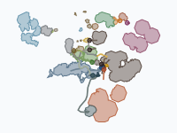
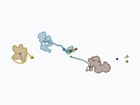
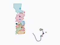
This map does the piecing together. In 35 keyframes it plays thirty years, from 1238 to June 1268: the Nilfgaardian Empire taking the kingdoms south of the Amell mountains, the fall of Cintra and the battles of Sodden in 1263, then the Second War from the Thanedd coup to the Peace of Cintra. Spoilers ahead: the map and this article give away how the wars of all five novels end. The map follows the books only (the games' later war and the Netflix series are not on it) and is an unofficial fan work.
The Empire Comes North, 1239–1257
The first frame is 1238, a year before anything happens: twenty-three coloured territories, from Kovir and Poviss in the far north to the dark block of Nilfgaard in the south. In 1239 the emperor the books only call the Usurper annexes Ebbing, which imperial historians count as the start of the Northern Wars (the North begins its own count in 1263). Metinna, Nazair and Maecht follow. All that is certain is that they had fallen by the mid-1250s, so the map's 'c. 1245', 'c. 1250' and '1250s' are placeholders and the order is a guess. In 1257 the Usurper is killed in a palace coup and Emhyr var Emreis takes the throne, the emperor who will order both invasions of the North.
Cintra and Sodden Hill, 1263
In 1263 Field Marshal Menno Coehoorn brings the imperial army over the Amell by the pass of the Marnadal Stairs and destroys the army of Cintra at its mouth, where King Eist Tuirseach is killed. The capital is sacked, Queen Calanthe throws herself from a tower and her granddaughter Ciri escapes through the burning streets. On the map the teal of Cintra goes dark and never comes back. The army burns the south of Sodden, wins a first battle there and stands north of the Yaruga.
On a hill in Lower Sodden it meets the armies of Temeria, Redania, Aedirn and Kaedwen and twenty-two sorcerers led by Vilgefortz of Roggeveen. Thirteen of the mages die; the obelisk on the hill carries fourteen names, because Triss Merigold was counted among the dead. Nilfgaard falls back behind the river, keeping Cintra and Upper Sodden, and the caption '1264 · Armed peace on the Yaruga' holds for three years, while the Scoia'tael, elves and dwarves armed by Nilfgaard, begin a guerrilla war in the North.
Thanedd and the Summer of 1267
In 1267 the rulers of the North meet in secret at Hagge and decide to strike first and take back Cintra. Emhyr hears of it and gathers an army in Dol Angra. On the night of 1 July troops under Lyrian and Aedirnian colours attack the imperial fort of Glevitzingen, which is pretext enough, and the sorcerers' conclave on the island of Thanedd tears itself apart. Philippa Eilhart and Dijkstra's Redanians arrest Vilgefortz, the hero of Sodden Hill, and the other mages in Nilfgaard's pay; Tissaia de Vries sets them free and the arrest becomes a battle. Vilgefortz escapes, King Vizimir of Redania is murdered, and the Brotherhood of Sorcerers that won the last war ceases to exist.
The arrow 'Invasion through Dol Angra, 1267' goes into Lyria. The army of Demavend of Aedirn and Queen Meve of Lyria is beaten at Aldersberg, and Vengerberg, Aedirn's capital, is sacked after a week's siege. On the frame 'Aug 1267 · Aedirn carved up; Verden submits' the gold of Aedirn is gone: Henselt of Kaedwen, by a pact with the invader, takes everything north of the river Dyfne, Emhyr gives Dol Blathanna to the elves under Francesca Findabair, and Foltest of Temeria signs a truce. Verden turns grey, a vassal. After sixteen days Emhyr breaks the truce and three arrows close on Brugge, from Brokilon, from Verden and across the Yaruga. Sodden is overrun, and after a victory at Maribor Emhyr stops: 'Dec 1267 · Emhyr waits for spring'. One small dot in Angren: on 31 August Meve's guerrillas fight their way back over a bridge on the Yaruga, and the witcher who helps to hold it is knighted 'of Rivia' for it.
Brenna and the Peace of Cintra, 1268
The spring offensive of 1268 was to finish the job with three forces, which the legend names: Army Group Centre under Coehoorn, Army Group East under Duke Ardal aep Dahy and the Verden Operations Group under Duke Joachim de Wett. It came apart in the west, where Verden rose and pinned de Wett down. Coehoorn marched from the river Ina with over 100,000 men, besieged Mayena again and rode with his cavalry against the allied army coming to relieve it. Between the river Chotla and the burnt village of Brenna, Jan Natalis and King Foltest, with Redanians, dwarves of Mahakam and the condottieri of the Free Company, destroyed Army Group Centre. Coehoorn was killed in the rout.
Natalis then routs the infantry coming up from Mayena and frees Brugge, while de Wett pulls back across the Yaruga. In the east Ardal aep Dahy dies, and Demavend and Henselt, reconciled, win the second battle of Aldersberg and push south to Dol Angra. The peace signed in Cintra on 2 April 1268 gives Temeria Sodden, Riverdell and Angren, so that it more than doubles in size on this map. Brugge and Lyria are handed back, Dol Blathanna stays elven as an allod sworn to Aedirn (a paler pink from here on), and Kaedwen has to return Upper Aedirn. Cintra stays with the Empire, because Emhyr marries its heiress Cirilla, in truth a double; even so Nilfgaard ends the war with less land on the map than it began with. The last frame is June 1268: a market quarrel in Rivia turns into a pogrom against non-humans, and Geralt is struck down defending them, on 6 June by the books.
Books, Games and Guesswork
The events, their order and the terms of the peace come from the books. The years are those of the Witcher Wiki's book timeline, and the Polish wiki's page-by-page chronology gives the same ones, with the warning that no official chronology exists and the books sometimes contradict each other. The small print differs: the English wiki dates the first war 'around 1262–1263' and Marnadal to July, where the Polish chronology reads The Tower of the Swallow as placing the invasion of Cintra after the summer. So read the months before July 1267 as an order of events only (the 1263 campaign is spread from March to July to space its frames) and most days after it as spacing. The books fix only a few, among them 1 July and 31 August 1267 and 2 April and 6 June 1268.
No border line on the map is Sapkowski's: the books give borders only in words (the games and the series had to draw their own maps too). The coastline, rivers and mountains are an original drawing after the geography the novels describe, in the arrangement most fan maps share. Where the books leave the layout open the choices are the map's: Riverdell and Angren north of the Yaruga, Upper Sodden south of it as far as the Amell, Dol Angra turning dark in 1264.
Nothing is taken from the games on purpose. CD PROJEKT RED's third war of 1271–72 is not on the map, and where The Witcher 2 dates the Rivia pogrom to 25 September the map keeps the book's June. One label leans the games' way: the pins call Upper Aedirn 'the Lormark', its name in The Witcher 2. The army that comes through Dol Angra in July 1267 is Menno Coehoorn's, as in Time of Contempt; Army Group East and its commander Ardal aep Dahy belong to the plan for 1268. The Netflix series has its own timeline and map (its fifth and final season had not been released as of November 2026); it is not used.
How to Read the Map
Each colour is a kingdom, laid as a pale wash over the ink drawing. 'Nilfgaardian Empire and its provinces' is the dark slate that grows from the south; inside it 'Toussaint (vassal duchy of Nilfgaard)' stays mauve throughout. Of the lands that change hands, Cintra is teal, 'Sodden and its marches (Riverdell, Angren)' tan, Brugge terracotta, Verden olive, 'Lyria and Rivia' purple, Aedirn gold and 'Dol Blathanna (elves)' pink. Temeria is blue, Kaedwen green, Redania red. Armies are small blocks that slide between frames (near-black for Nilfgaard, dark red for the North, dark green for Kaedwen); their size says nothing about an army's strength. Arrows are invasions. Eight large pins pause the playback at the turning points and twenty small dots carry the lesser events.
How the Map Was Made
The realms are assembled from 56 province pieces grown on the basemap's land. Sources: Andrzej Sapkowski's Sword of Destiny and the novels Blood of Elves, Time of Contempt, Baptism of Fire, The Tower of the Swallow and The Lady of the Lake, by way of the Witcher Wiki, a fan wiki that cites the books. In November 2026 the map was checked against the books again: the Thanedd and Sodden Hill pins were rewritten, and the Peace of Cintra now returns Upper Aedirn to Aedirn (the English wiki's treaty page speaks of a payment; its Lormark page and the Polish wiki have the land handed back).
The basemap is an original fan map of the Continent, drawn for Moving Polygons after the novels of Andrzej Sapkowski; no existing map was traced. The Witcher world, its places and its names are © Andrzej Sapkowski, and "The Witcher" is a trademark of CD PROJEKT S.A. This is an unofficial, non-commercial fan work, not affiliated with or endorsed by Andrzej Sapkowski, his publishers, CD PROJEKT RED or Netflix.
Chronological Timeline
- 1239 — The Usurper annexes Ebbing; for Nilfgaard's historians the Northern Wars begin
- c. 1245 to the 1250s — Metinna, Nazair and Maecht fall (years estimated)
- 1257 — Emhyr var Emreis takes the throne of Nilfgaard
- 1263 — Battle of Marnadal; Slaughter of Cintra; Battle of Sodden Hill
- 1 July 1267 — Thanedd coup; Nilfgaard invades Lyria and Aedirn
- Summer 1267 — Aedirn falls and is partitioned; Brugge and Sodden invaded
- 31 August 1267 — Battle for the Bridge on the Yaruga
- March 1268 — Battle of Brenna; second battle of Aldersberg
- 2 April 1268 — Peace of Cintra
- 6 June 1268 — Pogrom in Rivia
A free, non-commercial fan map: watch it, embed it on your own website or export it as a GIF, as long as it is not used commercially and the credit stays visible.
Explore the full interactive map →More invented wars on a fan map: Game of Thrones, seasons 1 to 8, with every army on the march.
Read about the Game of Thrones war map →Frequently asked questions
- What are the Northern Wars in The Witcher?
- The wars between the Nilfgaardian Empire and the Northern Kingdoms in Andrzej Sapkowski's Witcher books. Imperial historians count them from the annexation of Ebbing in 1239; the North counts from 1263, when Nilfgaard took Cintra and was stopped at Sodden Hill. The Second War ran from the Thanedd coup of 1 July 1267 to the Peace of Cintra on 2 April 1268. A third war, in 1271–72, exists only in CD PROJEKT RED's games.
- When was the Battle of Sodden Hill, and how many mages died there?
- In 1263 by the Witcher Wiki's book timeline; the books give no day. On a hill in Lower Sodden the armies of Temeria, Redania, Aedirn and Kaedwen and twenty-two sorcerers led by Vilgefortz of Roggeveen stopped Menno Coehoorn's Nilfgaardian army. Thirteen of the mages died. The obelisk on the hill carries fourteen names, because Triss Merigold was counted among the dead.
- What happened at the Thanedd coup?
- On the night of 1 July 1267, at the sorcerers' conclave on the island of Thanedd, Philippa Eilhart and Dijkstra's Redanians arrested Vilgefortz and the other mages in Nilfgaard's pay. Tissaia de Vries set them free and the arrest became a battle. Vilgefortz escaped, King Vizimir of Redania was murdered, the Brotherhood of Sorcerers ceased to exist, and Nilfgaard invaded Lyria and Aedirn through Dol Angra.
- How did the Second Northern War end?
- With the Battle of Brenna and the Peace of Cintra. In March 1268 Jan Natalis and King Foltest of Temeria destroyed Menno Coehoorn's Army Group Centre between the river Chotla and the burnt village of Brenna, and Coehoorn was killed in the rout. The peace of 2 April 1268 gave Temeria Sodden, Riverdell and Angren, handed Brugge and Lyria back, made Dol Blathanna an elven allod sworn to Aedirn and made Kaedwen return Upper Aedirn. Cintra stayed with Nilfgaard, because Emperor Emhyr married its heiress Cirilla, in truth a double.
- Is there an official map of the Witcher world?
- No. Andrzej Sapkowski never put a map in the Witcher books; by the Witcher Wiki's account he keeps his own unpublished and calls the fan maps "more or less correct". The games and the Netflix series had to draw their own. The basemap of the Moving Polygons map is an original fan drawing after the geography the novels describe in words, so every border on it is an interpretation.
- Does the map follow the Witcher books, the games or the Netflix series?
- The books: Sword of Destiny and the novels Blood of Elves, Time of Contempt, Baptism of Fire, The Tower of the Swallow and The Lady of the Lake. The games' third war of 1271–72 and the Netflix series are not shown, and the Rivia pogrom is on the book's date of 6 June 1268, where The Witcher 2 has 25 September. Two labels lean towards the games: the name Lormark for Upper Aedirn, and Ardal aep Dahy as commander of the invasion of July 1267, which in Time of Contempt is led by Menno Coehoorn.
- Is there an animated map of the Northern Wars from The Witcher?
- Yes. Moving Polygons has an animated fan map of the Northern Wars after Andrzej Sapkowski's books, from 1238 to June 1268, in 35 keyframes on an ink map of the Continent. Each kingdom is a colour, the dark Nilfgaardian Empire grows from the south, armies move as blocks and invasions as arrows, and eight large pins and twenty small dots explain the events. It is a free, unofficial, non-commercial fan map: you can watch it, embed it and export it as a GIF.
Text version of the map (timeline, layers and events): Markdown