Spoiler warning: the map and this article cover all eight seasons of Game of Thrones, up to the last scene of the last episode.
Eight Seasons, One Map
On the night Tyrion's wildfire burns Stannis's fleet in Blackwater Bay, Daenerys is in Qarth, about 8,400 km (5,200 miles) away, Robb Stark is campaigning in the Westerlands, Theon is holding Winterfell and Jon Snow is a prisoner of the wildlings beyond the Wall. Game of Thrones cuts between them as if they lived next door. This map puts them all on one cloth at once, every army, fleet and dragon of seasons 1 to 8, so you can see how far apart the show's places are, who was where on the same night and how long the marches take.
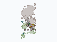
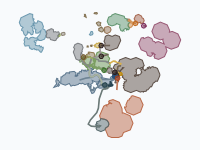
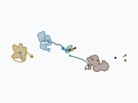
Each commander is a token that slides along a dated route with a trail behind it, on an embroidered-linen map of Westeros and Essos. The land is stitched in the colour of the side that holds it, from the Starks and Lannisters of 298 AC to the six kingdoms of Bran the Broken in 305. One warning before the numbers: the show almost never says what day it is, so the calendar on the time bar is a reconstruction (more on that below), and every date in this article is the map's.
The Distances the Show Leaves Out
All distances here are measured on the map, which is drawn on a fan-made map of the known world at roughly the scale of the books (its Wall is about 430 km or 265 miles long, against the 300 miles George R.R. Martin gives it). Winterfell is about 2,600 km (1,600 miles) from King's Landing in a straight line, and Castle Black another 1,000 km (625 miles) north. Dragonstone, which season 7 treats almost as a suburb of the capital, is about 680 km (420 miles) away at the mouth of Blackwater Bay. Essos is where the scale really bites. Meereen is almost 7,000 km (4,300 miles) from Winterfell and about 5,100 km from Dragonstone in a straight line; Daenerys's armada, sailing round Valyria, past Volantis and through the Stepstones, covers about 8,600 km (5,400 miles) to get there, in 46 days.
Some of the show's neighbours really are close. Hardhome lies about 250 km (155 miles) up the coast from Eastwatch, and the frozen lake of the wight hunt about 186 km (115 miles) beyond it. The North is the opposite case: on this map it covers about half as much land as all the kingdoms south of the Neck together, and Last Hearth, the Umbers' seat that the dead reach in season 8, is about 700 km (440 miles) from Winterfell.
Who Was Where on the Same Night
The show edits its storylines into separate scenes; the map runs them side by side, with up to eighteen tokens on screen at once (in late May and early June 303, just before the two battles of season 6, episode 9). Some of the pairings are worth pausing on. In season 3, episode 9, Daario, Jorah and Grey Worm slip into Yunkai on the night of 5 August 300, and the next night Robb, Catelyn and Talisa are murdered at the Twins, about 6,500 km (4,000 miles) to the west. When the dead fall on Hardhome on 22 March 302, Jaime is at the Water Gardens of Dorne, some 5,100 km (3,200 miles) to the south, Stannis is snowbound short of Winterfell and Daenerys is in Meereen.
The ninth episode of season 6 has two battles, and the map puts them ten days apart: the masters' fleet burns at Meereen on 10 June 303 and the Knights of the Vale break Ramsay's army outside Winterfell on 20 June. In season 7 the Unsullied take Casterly Rock through Tyrion's sewer on 16 January 304 while the Lannister army is a day away from storming Highgarden, about 960 km (600 miles) to the south-east, which is the whole point of the trick. And on the night of the Long Night at Winterfell, the map shows just how empty the south is: Cersei in the Red Keep, the Golden Company at King's Landing and Euron's fleet in Blackwater Bay, waiting.
How Long the Marches Take
Because every leg has a start and an end date, the map can say how long a journey lasts, as long as you remember that the dates are estimated. Robb leaves Winterfell on 2 October 298, reaches the Twins on 8 November and wins at the Whispering Wood on 20 November: five weeks to the Twins and seven to his first victory, and on 5 December his lords hail him King in the North at Riverrun. King Robert's party needs two months, from 6 March to 5 May 298, for the 2,600-odd km home down the Kingsroad. After Drogo's pyre Daenerys's remnant spends four months crossing the Red Waste, from December 298 to April 299, before Qarth takes it in.
Stannis leaves Castle Black on 20 December 301 and is stopped by snow short of Winterfell on 6 February 302; he sits in that camp until the end of May (Shireen is burned on 3 May) and is destroyed on 2 June, more than five months after setting out for a castle 1,000 km away. Jon, whose army has to be raised before it can march, takes four months and about 1,500 km of detours by the Bay of Ice and Deepwood Motte to go from Castle Black to the Battle of the Bastards. The army of the dead is the slowest thing on the map: from the fall of the Wall at Eastwatch on 28 August 304 to Winterfell on 10 December it covers about 1,070 km in 104 days, ten kilometres a day. Jaime, riding alone from Winterfell back to Cersei in season 8, does about 2,600 km in 58 days.
Where the show compresses a journey, the map stretches the dates inside the season, and season 7, episode 6 shows the limit of that. Jon's party leaves Eastwatch on 15 May 304 and the dead trap it on a frozen lake on 30 May. Daenerys leaves Dragonstone, about 3,100 km (1,930 miles) from Eastwatch, on 1 June and arrives with three dragons on 4 June. Even with five days on the lake, Gendry's run back to Eastwatch and a raven's 3,100-km flight to Dragonstone have to fit into two of them.
How to Read the Map
Discs are armies and travelling parties, sized roughly by strength; little ships are fleets, and the three-lobed darts are dragons. The band behind a token is its trail, about the last forty days of its route, and it fades a couple of weeks after the campaign ends. The coloured land shows who held it: brick red for the Lannisters and the Iron Throne, slate blue for the Starks and the North, green for the Tyrells, dark teal for the Ironborn, pink for the Boltons, orange for Dorne, pale blue for the Vale, charcoal for Daenerys and her allies, ice blue for the Night King and the dead, and a sage green for the six kingdoms under Bran at the very end. Bare linen is land nobody on the map is fighting for. The caption under each of the 689 keyframes starts with the season (S1 to S8) and says what happens in that frame; 62 pins pause playback at the turning points, and 230 small dots mark the skirmishes, sieges and arrivals around them. Ignore the day on the time bar when you compare with the show and follow the season tag instead.
How the Map Was Made
The research was done in four parts (seasons 1 and 2, seasons 3 to 5, seasons 6 to 8, and Essos and the Wall) and produced dated itineraries for about 120 armies, fleets, dragons and travelling parties, with the events taken from the episodes and checked against the Game of Thrones Wiki, and the geography from A Wiki of Ice and Fire. Each season has a window of roughly a year, from 298 AC for season 1 to 304–305 for season 8, so the whole story runs from 1 February 298 to 24 June 305, about seven and a half years; events seen on screen are dated in episode order, and the legs between them are spaced at plausible speeds (an army on foot covers 20 to 30 km a day). Land routes follow the roads, fleets keep to the sea, and places that are missing from the base map, such as Hardhome or the frozen lake, are estimated. An automatic check confirms that no token jumps between keyframes, that every army is where the research puts it at its documented stops and that every turning point has its pin. In November 2026 the captions were rewritten and a few routes corrected: Melisandre now lands on the shore of Blackwater Bay instead of in King's Landing, and Jon's last journey ends at Castle Black, where he leads the free folk north.
The base map is the Game of Thrones map data by cadaei, after maps by Tear, theMountainGoat, Werthead and Other-in-Law (CC BY-NC-SA 3.0); the world of A Song of Ice and Fire is copyright George R.R. Martin. This is a non-commercial fan map, not affiliated with or endorsed by HBO or George R.R. Martin.
Chronological Timeline
- S1E1, Feb 298 — Jon Arryn dies; King Robert rides north to Winterfell
- S1E9–E10, Nov–Dec 298 — Battle of the Whispering Wood; Ned Stark executed; Robb proclaimed King in the North; Daenerys's dragons hatch
- S2E9, Sep 299 — Battle of the Blackwater
- S3E9, Aug 300 — Yunkai taken; the Red Wedding
- S4E2–E4, Nov–Dec 300 — The Purple Wedding; Meereen taken
- S4E9–E10, Jun 301 — Battle of Castle Black; Tywin killed by Tyrion
- S5E8, Mar 302 — Massacre at Hardhome
- S5E9–E10, May–Jun 302 — Daznak's Pit; Stannis destroyed outside Winterfell; Jon murdered
- S6E9, Jun 303 — Battle of Meereen; Battle of the Bastards
- S6E10, Jul 303 — The Great Sept destroyed; Daenerys sails for Westeros
- S7E1–E4, Sep 303–Mar 304 — Daenerys lands at Dragonstone; Euron destroys Yara's fleet; Casterly Rock and Highgarden fall; the Loot Train
- S7E6–E7, Jun–Aug 304 — Battle on the frozen lake; Dragonpit truce; the Wall falls at Eastwatch
- S8E3, Dec 304 — The Long Night at Winterfell
- S8E5–E6, May–Jun 305 — The Bells; Daenerys killed; Bran chosen king; Jon leads the free folk beyond the Wall
A free, non-commercial fan map: watch it, embed it on your own website or export it as a GIF, as long as it is not used commercially and the credit stays visible.
Explore the full interactive map →Some 170 years earlier on the same linen: the Dance of the Dragons, the Targaryen civil war of Fire & Blood and House of the Dragon, with every dragon flight of 129–131 AC.
Read about the Dance of the Dragons map →Frequently asked questions
- How far is Winterfell from King's Landing?
- Measured on the fan map that the Moving Polygons map is drawn on, about 2,600 km (1,600 miles) in a straight line. Castle Black is about 1,000 km (625 miles) north of Winterfell, and Dragonstone about 680 km (420 miles) from King's Landing. On the map's reconstructed calendar King Robert's party needs two months, from 6 March to 5 May 298, to ride home down the Kingsroad.
- When does Game of Thrones take place?
- The show gives almost no dates. The map uses a reconstruction from 298 AC, when Jon Arryn dies, to 305 AC, when Bran is chosen king and Jon Snow goes north of the Wall: each season gets a window of roughly a year, episodes follow in order and marches are spaced at plausible speeds. So the whole story runs about seven and a half years on the map, but every day and month in it is an estimate.
- Where was Daenerys during the Red Wedding?
- Taking Yunkai, in the same episode (season 3, episode 9). On the map's calendar Daario, Jorah and Grey Worm open Yunkai on the night of 5 August 300 and the Red Wedding follows the next night at the Twins, about 6,500 km (4,000 miles) away.
- How long did Robb Stark's march south take?
- On the map's reconstructed calendar Robb leaves Winterfell on 2 October 298, reaches the Twins on 8 November and wins the Battle of the Whispering Wood on 20 November: five weeks to the Twins and seven to his first victory. He is proclaimed King in the North at Riverrun on 5 December 298.
- How did Daenerys reach Jon beyond the Wall so fast in season 7?
- The show does not say. The frozen lake is about 186 km (115 miles) beyond Eastwatch, and Eastwatch is about 3,100 km (1,930 miles) from Dragonstone. The map stretches the episode as far as it can: the dead trap Jon's party on 30 May 304, Daenerys leaves Dragonstone on 1 June and arrives on 4 June. That still leaves Gendry's run back to Eastwatch and a raven's 3,100-km flight squeezed into two days.
- Is there an animated map of the wars in Game of Thrones?
- Yes. Moving Polygons has a free animated map of all eight seasons on an embroidered-linen map of Westeros and Essos: armies march as discs, fleets sail as little ships and dragons fly as darts, each with a trail behind it, while the land changes colour with the side that holds it. It has 689 keyframes, 62 pins for the turning points and 230 small dots for the events around them. It is a non-commercial fan map: you can watch it, embed it and export it as a GIF.
Text version of the map (timeline, layers and events): Markdown