Did the Lighthouses Work?
In 1700 about five lights marked the whole coast of Ireland; by 1875 almost every headland had one. If a lighthouse does what it is built for, the wrecks around it should stop, and Ireland is a good place to check, because the National Monuments Service keeps the Wreck Inventory of Ireland: about 18,000 recorded losses, most of them with a date and a place. The short answer: near a new light there were about 18% fewer wrecks than the trend predicted, at Fastnet and Tuskar Rock the count went up, and the real fall came decades after the lights were built, along the whole coast at once.
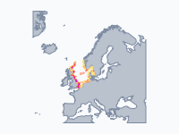
On the map, red patches are the wrecks of the ten years before each date and yellow dots are the lights, each switched on in the year it was first lit. Keep an eye on Dublin Bay: it takes the deepest colour on the map in the 1760s and keeps it for a century and a half, while Poolbeg, the Kish lightship, the Baily and finally the Muglins are lit around it.
The Armada Coast, 1588
The map opens in September 1588. The Spanish Armada, beaten in the Channel and sent home the long way round Scotland, met the Atlantic gales off the west coast of Ireland and lost one ship after another. The Santa Maria de la Rosa dragged her anchors in Blasket Sound and sank with a single recorded survivor. At Streedagh in Sligo three ships were driven ashore together; Captain Francisco de Cuellar survived and left a famous account of his escape. The worst came last: the galleass Girona, overloaded with survivors of other wrecks, sailed from Killybegs for Scotland, lost her rudder and struck Lacada Point near the Giant's Causeway. Of about 1,300 aboard, nine survived.
There were almost no lights for them to see. The tower that William Marshal built on Hook Head in Wexford in the early 13th century, first tended by monks, already carried a light (it still does, which makes it the oldest working lighthouse in Ireland and one of the oldest in the world). The rest of the coast was dark and would mostly stay so for nearly two more centuries.
Five Fires for a Whole Coast
In 1700 the lights of Ireland could be counted on one hand: the tower at Hook Head, a light at Blackrock Castle in Cork Harbour, and coal fires burning on the roofs of cottages on the Old Head of Kinsale, on Howth Head and at Loop Head, put up in the 1660s and 1670s (and not always kept burning: the fire on the Old Head was let go out for a time after 1683). Meanwhile coal brigs crowded the Irish Sea, Dublin's port grew with them, and from the 1760s the wreck record thickens.
The early hotspots are Dublin Bay and the sandbanks off Wicklow and Wexford: the Kish, the Arklow Bank and the Blackwater, long low banks that a ship could hit without ever seeing land. Poolbeg, at the end of Dublin's Great South Wall, was lit in 1768 and Wicklow Head in 1781, and in 1795 the map still shows only about a dozen. Dublin's Ballast Board, founded in 1786 to run the port, was given all the lights of the Irish coast in 1810. A lightship was moored on the Kish Bank the next year, and the great building years followed: the Baily in 1814 (moved down from the summit of Howth Head, which was often in cloud), Tuskar Rock in 1815, Fanad Head and Roche's Point in 1817 and Fastnet in 1854.
Disasters That Built Lights
Many Irish lights and harbours were a direct answer to a disaster, and the map puts the red pin and the yellow dot side by side. In November 1807 the troop transports Prince of Wales and Rochdale left Dublin and were driven onto the rocks that same night at Blackrock and Seapoint, half a mile apart. About 385 people died within sight of the shore; the outcry led to the harbour of refuge at Dún Laoghaire, begun in 1817. The frigate HMS Saldanha was driven ashore leaving Lough Swilly in 1811 and all 253 aboard died; Fanad Head lighthouse, built in 1817, guides ships into the lough. The transport Sea Horse, full of soldiers and their families, mistook Tramore Bay for Waterford Harbour in 1816 and was wrecked below the cliffs with 363 dead; in 1823 the Metal Man and his warning beacons went up on the headland.
The pattern carried on through the Famine years. In January 1847 the pioneering Atlantic steamer Sirius, by then a Cork–Dublin packet, hit rocks near Ballycotton in fog and twenty people died; Ballycotton lighthouse was built in 1851. That November the American packet Stephen Whitney mistook Roaringwater Bay for Cork Harbour in fog and struck rocks near Schull, and 92 of the 110 aboard died; a review of the south-coast lights led to the lighthouse on the Fastnet Rock.
Some wrecks no light could have prevented. In January 1854 the brand-new iron clipper Tayleur, on her maiden voyage to Australia with emigrants, was driven onto Lambay with her compasses thrown off by her own iron hull. Of more than 650 aboard about 280 survived, and the inquiry drew attention to compass errors in iron ships. In 1859 the emigrant ship Pomona ran onto the Blackwater Bank, which had had a lightship since 1857, and 424 of the 448 aboard drowned.
What the Numbers Say
To test the idea, we took every lighthouse and lightship with enough data, counted the recorded wrecks within 15 km in the 20 years before it was first lit and the 20 years after, and compared the second count with what the national trend predicted. Across 62 lights there were about 18% fewer wrecks near a new light than expected (13% to 18%, depending on whether the circle is drawn at 5, 10 or 15 km). One warning: lights were built where the last years had been bad, and a bad stretch is usually followed by a calmer one whether or not anything is built, so 18% is the most the lights can claim. The same test on the sister maps gives about 12% for the North Sea and no difference at all for North America's Atlantic coast as a whole.
The Muglins, a rock off Dalkey lit in 1906, is the textbook case: 187 wrecks nearby in the 20 years before and 48 after, where the trend predicted 172. Broadhaven Bay in Mayo (1855) went from 40 to 4, and the Baily from 189 to 128 when 253 were expected. At the typical light, though, the count simply followed the national trend, and at Fastnet (1854) and Tuskar Rock (1815) there were more wrecks than expected after the light was lit. Partly that is the records: once a lighthouse stands on a rock, wrecks get reported as '2 miles from Tuskar light', which moves them towards it on the map. Partly it is seamanship: a light shows where the danger is, but a sailing ship on a lee shore in a gale still goes where the wind takes her.
Steam, Iron and Radio
The big fall came later, and everywhere at once. The worst decade on the map is the 1850s, with about 159 recorded wrecks a year; by the 1930s the inventory records about 22 a year. In between came telegraph storm warnings (from 1861), the Plimsoll load line against overloaded 'coffin ships' (1876), steam overtaking sail (1883), iron and steel hulls and better charts. The two world wars push the count back up: the Lusitania, torpedoed off the Old Head of Kinsale in 1915 with about 1,200 dead, and the mail boat Leinster, torpedoed off the Kish in October 1918, with between 500 and about 570 dead the worst loss of life in the Irish Sea.
Communications arrived early on this coast. The first transatlantic telegraph cable came ashore at Valentia in 1858; forty years later Marconi's team linked Rathlin Island and Ballycastle by wireless, and in 1902 wireless stations opened at Malin Head and Crookhaven. Radio beacons, radar, VHF, GPS and AIS followed, and the keepers left; the Baily was the last Irish lighthouse to be automated, in 1997. Wrecks have not stopped (the ghost ship Alta drifted across the Atlantic for 16 months before running aground near Ballycotton in 2020), but they have become rare enough that each one is remembered by name. For scale: in 1867 the Board of Trade counted 2,513 wrecks and casualties on the coasts of Britain and Ireland in a single year, with 1,333 lives lost. In 2024 the whole world lost 27 large ships.
How to Read the Map
The wreck patches come in three classes, counted over the ten years before each date: orange for one or more wrecks per 100 km², red for four or more, magenta for twelve or more. (The sister maps use other thresholds, so compare patterns between them, not colours.) The soft yellow glow around a light is the sea within its range, drawn schematically: up to 8 nautical miles before 1810, 12 before 1860 and 15 after. Red pins tell the big stories, blue pins mark changes in technology, and the small dots are about 1,100 individual wrecks, a selection from the roughly 16,000 that could be placed: click one for its inventory entry. The bar at the top shows recorded wrecks per year as a ten-year average.
The inventory covers the waters of the Republic of Ireland only, so Northern Ireland's waters are greyed out (its lights are shown). It is complete only to 1946, so the empty sea after 1950 means 'not recorded', not 'no wrecks'. And early records are thin because fewer were kept, not because fewer ships were lost.
How the Map Was Made
The wrecks come from the Wreck Inventory of Ireland (National Monuments Service, published on data.gov.ie under CC BY 4.0). Most 18th- and 19th-century records give only a place in words, such as 'Tuskar Rock, 4 miles SE'. We read those texts and matched them to GeoNames places (CC BY 4.0) and to the positions of the lighthouses, using the distance and direction where given. About 88% of the records could be placed; checked against the records that do have coordinates, the median error is about 1.5 km. The hotspots are a smoothed density of those points. The 126 lighthouses, lightships, harbour lights and daymarks and their first-lit dates were researched from the Commissioners of Irish Lights station histories, Wikipedia and Russ Rowlett's Lighthouse Directory. The stories draw on Wikipedia, the RNLI's Lifeboat journal archive (with the Board of Trade wreck registers) and the Allianz Safety and Shipping Review 2025.
Chronological Timeline
- Early 13th century — William Marshal's tower at Hook Head carries a light
- September–October 1588 — Armada ships wrecked from Kerry to Antrim; the Girona lost at Lacada Point
- 1807 — Prince of Wales and Rochdale lost in Dublin Bay, about 385 dead
- 1810 — Dublin's Ballast Board (founded 1786) takes over the lights of the whole coast
- 1847 — The Sirius near Ballycotton and the Stephen Whitney near Schull
- 1854 — The Tayleur wrecked on Lambay; Fastnet lit
- 1861 — Storm warnings by telegraph
- 1876 — The Plimsoll load line
- 1906 — The Muglins lit off Dalkey
- 7 May 1915 — The Lusitania torpedoed off the Old Head of Kinsale
- 10 October 1918 — RMS Leinster torpedoed off the Kish
- 1997 — The last keepers leave the Baily
- 2020 — The ghost ship Alta runs aground near Ballycotton
Watch the wrecks come and go around Ireland in the interactive map, click any dot for its record in the inventory, or embed the map on your own site.
Explore the full interactive map →The North Sea, where the lights did a little less: the colliers' road from the Tyne to the Thames, the first lightships and the Lutine, from the Christmas storm at Texel in 1593 to the Fremantle Highway in 2023.
Read about the North Sea map →North America's Atlantic coast, where lighthouses beside the big ports made no measurable difference: from the treasure fleet of 1715 to the Titanic and the Andrea Doria.
Read about the Atlantic coast map →Frequently asked questions
- How many shipwrecks are there around Ireland?
- The Wreck Inventory of Ireland, kept by the National Monuments Service, holds about 18,000 records of ships lost in the waters of the Republic of Ireland, most of them with a date and a place. It does not cover Northern Ireland's waters and it is complete only up to 1946. The worst decade on record is the 1850s, with about 159 recorded wrecks a year; by the 1930s the count was down to about 22 a year.
- What is the oldest lighthouse in Ireland?
- Hook Head in County Wexford. The tower was built by William Marshal in the early 13th century and its light was first tended by monks. It is still working, which makes it the oldest working lighthouse in Ireland and one of the oldest in the world. Around 1700 it was one of only about five lights on the whole Irish coast.
- Did lighthouses reduce shipwrecks in Ireland?
- At some places clearly, on average a little. Across 62 Irish lights with enough data there were about 18% fewer recorded wrecks within 15 km in the 20 years after a light was first lit than the national trend predicted. The Muglins off Dalkey (lit 1906) went from 187 wrecks to 48 and Broadhaven Bay (1855) from 40 to 4. At the typical light nothing changed, and at Fastnet and Tuskar Rock the count went up. Because lights were built after bad years, which tend to be followed by calmer ones anyway, 18% is the most the lights can claim.
- Where were the most dangerous parts of the Irish coast?
- Dublin Bay and the sandbanks off Wicklow and Wexford (the Kish, the Arklow Bank and the Blackwater Bank), long low banks that a ship could hit without ever seeing land. On the map Dublin Bay carries the densest class of wrecks, twelve or more per 100 km² in ten years, from the 1760s into the 1900s. The Baily on Howth Head and the Muglins off Dalkey each had nearly 190 wrecks within 15 km in the 20 years before they were lit.
- What was the deadliest shipwreck in Irish waters?
- The deadliest wreck on the map is the Armada galleass Girona, which struck Lacada Point near the Giant's Causeway, in what is now Northern Ireland, in October 1588 with about 1,300 aboard; nine survived. In the waters of the Republic the worst is the Lusitania, torpedoed off the Old Head of Kinsale in 1915 with about 1,200 dead. The mail boat RMS Leinster, torpedoed in 1918 with between 500 and about 570 dead, is the worst loss of life in the Irish Sea.
- Which Irish lighthouses were built because of a shipwreck?
- Several. Fanad Head (1817) followed the loss of HMS Saldanha with all 253 aboard in 1811. Ballycotton (1851) followed the wreck of the steamer Sirius in 1847, and the Fastnet Rock lighthouse (1854) came out of a review of the south-coast lights after the Stephen Whitney was lost near Schull in 1847 with 92 dead. The harbour of refuge at Dún Laoghaire and the Metal Man beacons at Tramore were answers to disasters too.
- Is there an animated map of shipwrecks and lighthouses around Ireland?
- Yes. Moving Polygons has a free animated map that plays from the Armada of 1588 to 2026, with red hotspots for the wrecks of each decade, 126 lighthouses, lightships and beacons that appear at the date they were first lit, about 1,100 individual wrecks you can click, and pins for the big stories. It is one of three: sister maps cover the North Sea and North America's Atlantic coast. You can watch them and embed them on your own website.
Text version of the map (timeline, layers and events): Markdown